Despite today’s welcome rainfall there’s been a literal and figurative drought here in Virginia lately. The literal part has to do with the very dry conditions, with >75% of the state listed as “abnormally dry” on the latest Drought Monitor. The figurative part is the lack of convective opportunity which – to be fair – goes somewhat hand in hand with the dry weather.
The other factors involved in a dearth of September chasing are (a) the lack of Atlantic and Gulf of Mexico tropical activity, (b) the retreat of the jet stream northward into Canada and (c) a growing propensity for the dreaded cold air damming wedge to form. Today is a perfect example of the last factor as high pressure over New England and low pressure over the Southeast combine to create easterly winds which are banking moisture up against the mountains. “Da Wedge” will likely hold sway tomorrow – Tuesday – as well.
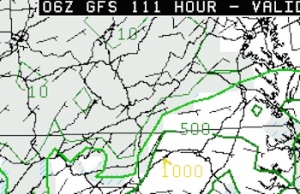
The worrisome part is that another wedge looks likely this coming weekend. Ahead of the onslaught of more cool stable air the GFS paints a (very) faint hope of instability Friday afternoon over southern portions of the Old Dominion.
This is not encouraging. Saturday’s forecast paints higher CAPE levels but they’re over eastern Virginia and northern North Carolina. Should that area creep further north a bit over the course of this week I could be looking at a chase chance…but I’m not holding my breath.
Sigh.

