
Tags
After watching snow falling twice over the past two and a half days my SDS level had ratcheted up to somewhere between the orange and red alarm levels. Thus when I checked model output across Virginia for this coming Sunday (4/15) I was actually excited to see CAPE and shear ahead of an approaching cold front.
Here’s the 12Z Monday Euro run showing surface based CAPE at 8 pm Sunday: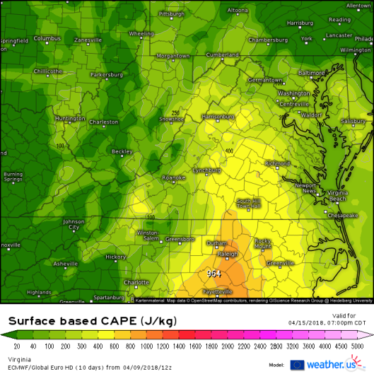
To go along with this the 12Z GFS shows this map of most unstable CAPE and 0-6 km shear at 5 pm Sunday: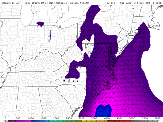
It’s still quite a ways off so we’ll see how this setup evolves over the next few days. But at least Sunday is on the chase radar.
The overall pattern looks like it will bring several more cold shots into the Mid-Atlantic between now and the end of April. That doesn’t bode well for the 2018 Virginia chase season as it reminds me of the 2007 pattern. That year brought April snow followed by a dearth of chaseable storms. Hopefully that analog won’t hold true.
