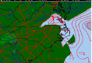
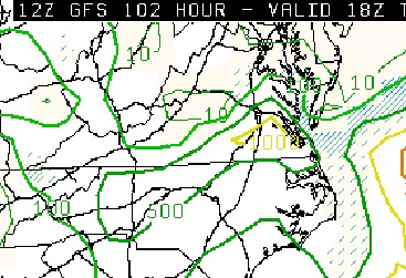
The GFS has remained consistent over the past few days regarding instability on the east side of the cutoff low forecast to cross North Carolina. This translates into the potential for storms in southeastern Virginia. Here are today’s 12Z forecast graphics for those two parameters:
 |
| Lifted Index and surface dew points |
 |
| Surface based CAPE |
Given the consistency of the GFS I am leaning toward a Tuesday afternoon chase in and around the I-85/I-95 corridors. Not sure yet that a lot of shear will be available but that’s still TBD. Storm motions will likely be east to west given the flow around the low center which is forecast to be due south of Richmond by that time.
Given the target location I may be chasing for WTVR CBS6 again Tuesday, altho’ it may be a bit earlier in the day than the April 19th events. Stay tuned!
